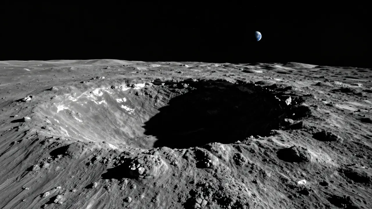
Imagine standing at the edge of a crater that has been in total darkness for billions of years. The temperature is near absolute zero. In that frozen shadow lies the key to humanity’s future in space: water ice. But you can’t just dig anywhere. You need a map. Not a tourist map, but a high-resolution, data-heavy blueprint that tells you exactly where to drill to find fuel, oxygen, and construction materials.
This is Lunar Resource Mapping, which is the scientific process of locating and quantifying exploitable resources like water ice and metal-bearing regolith across the Moon's surface. It is no longer just theoretical science. As of mid-2026, it is an active industry driving the Artemis program and commercial mining ventures. We are moving from asking "is there water?" to "where is the most accessible water?"
The Shift from Exploration to Prospecting
For decades, we knew the Moon had resources. Apollo samples showed us that lunar regolith contains about 45% oxygen by weight and mare basalts hold 14-17% iron. But knowing the average composition of the entire Moon doesn't help you build a mine. You need local concentrations.
Lunar resource mapping bridges this gap. It combines orbital spectroscopy, radar data, neutron measurements, and machine learning to create prospectivity maps. These maps predict where specific resources occur at economically useful levels. The goal is resolution: getting from global averages down to meter-scale precision so a rover knows exactly where to park its drill.
| Resource | Primary Location | Mapped Via | Primary Use |
|---|---|---|---|
| Water Ice | Polar Permanently Shadowed Regions (PSRs) | Neutron Spectrometers, Radar | Fuel (Hydrogen/Oxygen), Life Support |
| Iron & Titanium | Mare Basalts (Dark Plains) | Gamma-Ray/X-Ray Spectrometry | Construction, Electronics |
| Rare Earth Elements | KREEP-rich regions (e.g., Oceanus Procellarum) | Spectral Analysis, Gravity Data | High-value exports, Magnets |
| Helium-3 | Surface Regolith (Solar Wind Implantation) | Regolith Maturity Models | Future Fusion Fuel |
Hunting for Water in the Shadows
Water is the holy grail of lunar resource utilization. It can be split into hydrogen and oxygen for rocket propellant, or used directly for drinking and growing food. But finding it requires looking in the darkest places.
Water ice exists primarily in Permanently Shadowed Regions (PSRs) near the poles. These are craters so deep that sunlight never touches their floors. Estimates vary on the total area of these shadows-some models suggest over 31,000 km², while stricter definitions limit it to around 3,500 km²-but the consensus is clear: the poles are wetter than the rest of the Moon.
In July 2025, the U.S. Geological Survey (USGS) released the first off-planet mineral prospectivity map focused specifically on south-polar water ice. This wasn't just a picture; it was a probabilistic model. By integrating topography, thermal data, and neutron indicators, the USGS ranked areas by their likelihood of hosting accessible ice. This helps mission planners avoid landing in dry spots.
Current estimates suggest there may be more than 600 billion kilograms of water ice in polar regions. To put that in perspective, that’s enough to fill roughly 240,000 Olympic-sized swimming pools. However, quantity isn't everything. For mining to be viable, we need concentration. Experts argue that "usable" ice likely requires concentrations of at least 2% within the top meter of soil. If the ice is diluted to 0.1% across wide areas, the energy cost to extract it becomes prohibitive.
Mapping Metals and Rare Earths
While water gets all the attention, metals are essential for building infrastructure. You can't live on the Moon without shelter, power systems, and machinery. All of that requires aluminum, titanium, iron, and rare-earth elements.
Unlike water, which hides in the cold, metals are often found in the sunlit maria-the dark basaltic plains visible from Earth. Orbital gamma-ray and X-ray spectrometers have mapped elemental abundances for years. We know that ilmenite (an iron-titanium oxide) is abundant in lowland basalts. We also know that the lunar highlands are rich in anorthite, a calcium-aluminum silicate.
The real money maker might be rare-earth elements (REEs). Elements like scandium, yttrium, and the lanthanides are critical for electronics and renewable energy tech on Earth. On the Moon, they are concentrated in KREEP-rich regions (Potassium, Rare Earth Elements, and Phosphorus). Areas like Oceanus Procellarum and Mare Imbrium are prime targets. While exporting bulk metals to Earth is currently too expensive due to launch costs, extracting them locally for 3D-printing structures on the Moon is a viable strategy for the 2030s.
Tools of the Trade: From Orbit to Surface
How do we actually make these maps? It’s a layered approach using multiple instruments.
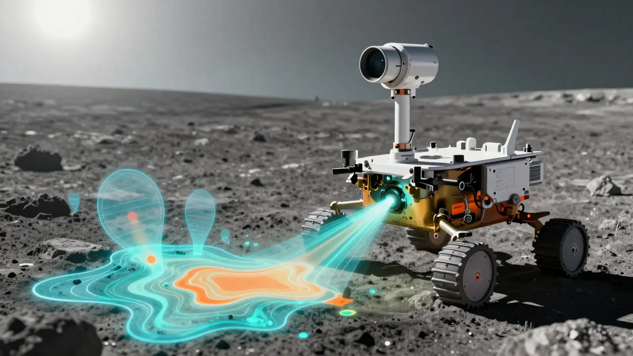
- Neutron Spectrometers: Instruments like those on the Lunar Reconnaissance Orbiter (LRO) detect neutrons bouncing off the surface. Hydrogen slows down neutrons, so a drop in neutron flux indicates the presence of hydrogen, likely from water ice.
- Radar: Radar penetrates the surface slightly and reflects differently off ice grains compared to dry rock. Chandrayaan-1 and LRO radar data have helped identify discrete ice deposits.
- Infrared Spectroscopy: Missions like NASA’s upcoming Lunar Trailblazer and the joint JAXA-ISRO LUPEX rover will use infrared sensors to detect the spectral signatures of water molecules and hydroxyl groups.
- Planetary Pedology: This is the study of lunar soil. Recent frameworks classify soil based on grain size, maturity, and cohesion. This helps engineers design drills and excavators. Loose regolith behaves differently than sintered, rock-hard surfaces.
Interactive tools like LROC QuickMap allow researchers to overlay these datasets. You can see high-resolution images alongside slope maps and hydrogen abundance layers. This integration is crucial for planning safe and productive landing sites.
Ground Truth: Verifying the Maps
Orbital data gives us probabilities. Ground truth gives us certainty. In February 2025, NASA launched PRIME-1 (Polar Resources Ice Mining Experiment-1) to the lunar south pole. Carrying Honeybee Robotics’ TRIDENT drill, this mission aims to physically sample the regolith and measure water content with a mass spectrometer.
Why is this important? Because orbital maps have a resolution limit. They tell you there is hydrogen in a square kilometer. They don't tell you if it's in one rich vein or spread thinly everywhere. PRIME-1, along with future missions like China’s Chang’e-7 and the LUPEX rover (scheduled for 2028), will validate these models at a meter scale. This feedback loop improves future maps, reducing uncertainty by factors of 3 to 10.
The Commercial and Legal Landscape
As we move toward extraction, the question of ownership arises. The Outer Space Treaty prohibits national sovereignty claims, but it doesn't explicitly ban resource extraction. This legal gray area has spurred the creation of commercial registries.
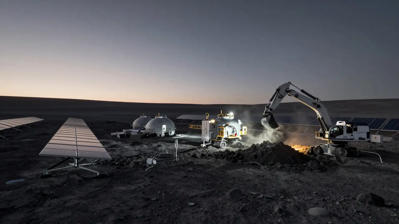
The Lunar Resources Registry (LRR), announced as a commercially viable product in March 2025, provides geospatial databases linking resource locations to potential commercial rights. It acts somewhat like a terrestrial mining claim system, offering transparency for investors. While no physical mining has occurred yet, companies are already treating these maps as strategic assets. The focus is shifting from pure science to In-Situ Resource Utilization (ISRU)-using what you find to support further exploration.
However, skepticism remains. Many experts warn that helium-3, often touted as a fusion fuel, is extremely difficult to extract, requiring processing hundreds of tons of regolith for a single gram. For now, water and construction materials offer a more immediate return on investment.
Where is the best place to look for water on the Moon?
The best places are Permanently Shadowed Regions (PSRs) near the lunar north and south poles. These are craters that never receive direct sunlight, allowing water ice to remain stable for billions of years. The south pole is currently considered more promising due to better access to sunlight for solar power nearby.
What is the difference between lunar resource mapping and regular geological mapping?
Regular geological mapping focuses on rock types, age, and history. Resource mapping adds a layer of economic viability, focusing on the concentration, depth, and accessibility of specific materials like water ice or metals. It uses probabilistic models to guide extraction efforts rather than just describing the landscape.
Can we mine metals on the Moon and bring them back to Earth?
Currently, it is not economically feasible to bring bulk metals like iron or aluminum back to Earth due to high launch costs. However, high-value, low-mass materials like rare-earth elements could potentially be exported in the future. Most metals mined on the Moon will likely be used locally for construction and manufacturing.
How accurate are current lunar water maps?
Current orbital maps provide good regional estimates but lack the precision needed for mining. They can identify areas with hydrogen enhancements, but cannot confirm exact ice concentration or depth. Missions like PRIME-1 and LUPEX are designed to ground-truth these maps, improving accuracy from kilometer-scale to meter-scale.