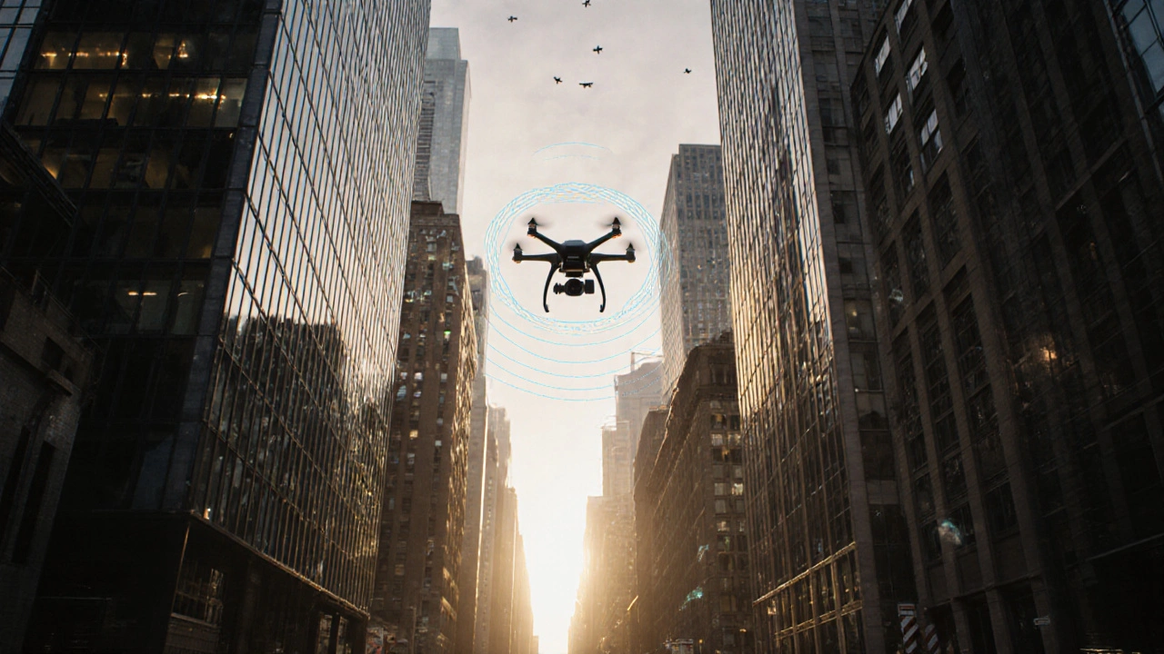
When you’re standing in the middle of Manhattan, Tokyo, or Berlin, your phone might show you’re on the right street-yet you’re actually 20 meters off. That’s not a glitch. It’s the urban canyon effect.
Urban canyons are the narrow streets squeezed between towering buildings. They block direct signals from GPS and other Global Navigation Satellite Systems (GNSS). The result? Your phone, car, or delivery drone loses its way. In these environments, signals bounce off glass and steel, creating false positions. Satellites disappear behind concrete walls. Even when signals get through, they’re weak, noisy, and unreliable.
Traditional GPS was never built for this. It assumes clear skies and open space. But today, over 70% of the world’s population lives in cities-and autonomous vehicles, delivery robots, and even emergency responders need to navigate them safely. So how do we fix it?
Why Urban Canyons Break GPS
GPS works by measuring how long it takes signals to travel from satellites to your device. But in dense cities, that simple process falls apart.
First, signal blockage. Tall buildings hide satellites. In a narrow street, you might only see 3-5 satellites instead of the 8-12 needed for accurate positioning. That’s not enough to calculate a precise location.
Second, multipath interference. Signals don’t just come straight down. They bounce off buildings, cars, and signs before reaching your receiver. Your device gets multiple versions of the same signal-each arriving at a slightly different time. The system doesn’t know which one is real, so it guesses wrong. This is the #1 cause of urban positioning errors.
Third, poor geometry. Even if you get enough signals, they might all come from the same direction-like satellites clustered above you. That makes it impossible to tell if you’re moving north or east. Research from University College London shows signal geometry drops by 60-70% across streets compared to along them. That’s why your phone thinks you’re on the wrong side of the road.
Real-world results? Without fixes, urban GPS errors average 13 meters horizontally and nearly 20 meters vertically. For a self-driving car, that’s dangerous. For a delivery robot, it’s a disaster.
How Shadow Matching Works
One of the earliest and most clever solutions came from Paul D. Groves at University College London in 2011: Shadow Matching.
The idea is simple: if you know what the city looks like, you can predict where satellites should be visible-and where they shouldn’t. Shadow Matching uses 3D building models to simulate the skyline from any given point. It compares that simulation to the actual satellite signals your receiver picks up.
For example: if your device detects a signal from a satellite that, according to the 3D map, should be blocked by a 30-story building, the system knows that signal is fake-likely a bounce. It ignores it.
When done right, Shadow Matching can reduce errors to under a meter, even across streets. But here’s the catch: it needs perfect 3D maps. And cities change fast. A new construction site, a temporary scaffolding, even a parked truck can break the model.
As Groves admitted in his original paper, this method works best in cities with stable, high-quality building data-like parts of Europe or Japan. In rapidly growing cities like Mumbai or Lagos, the maps are outdated before they’re even deployed. That’s why Shadow Matching hasn’t gone mainstream yet. It’s brilliant in theory, but fragile in practice.
The HK Model: Software That Fixes Old Hardware
What if you didn’t need new maps or fancy sensors? What if you could improve GPS accuracy just by changing the software in your existing receiver?
That’s the breakthrough from NIH researchers, published in March 2024. They created the HK model-a software algorithm that rethinks how GNSS receivers handle signal noise.
Instead of treating all satellite signals equally, the HK model watches how the signal strength (SNR) changes over time. In open areas, SNR is stable. In urban canyons, it jumps around wildly due to bouncing signals. The HK model detects those wild fluctuations and automatically reduces the weight of those signals in the positioning calculation.
The results? In real-world tests across city streets, horizontal error dropped from 13.0 meters to just 4.7 meters. Vertical error fell from 19.5 meters to 6.9 meters. That’s a 22.4-meter improvement in 3D accuracy.
And here’s the kicker: it works on any device with a standard GNSS chip. No new hardware. No 3D maps. Just a firmware update. The NIH team tested it on existing receivers for 24 hours straight-no drop in performance. It’s the cheapest, fastest fix available today.
It’s not perfect. During sudden weather changes-like a thunderstorm rolling in-signal noise becomes unpredictable, and the model struggles. But for most urban conditions, it’s a game-changer.
SmartNav: Sub-Centimeter Accuracy in Trondheim
Then there’s SmartNav, developed by NTNU in Norway. This isn’t just an improvement-it’s a redefinition of what’s possible.
SmartNav throws out traditional code-based positioning (which measures signal travel time) and instead uses carrier phase measurements. These are far more precise, tracking signal waves down to fractions of a millimeter.
But carrier phase alone is noisy. So SmartNav fuses it with data from Wi-Fi, mobile networks, and real-time 3D building models. It also uses inertial sensors to track movement between signal updates.
The result? In Trondheim’s dense downtown, SmartNav achieved better than 10-centimeter accuracy 90% of the time during tests in early 2025. That’s not “close enough.” That’s lane-level precision.
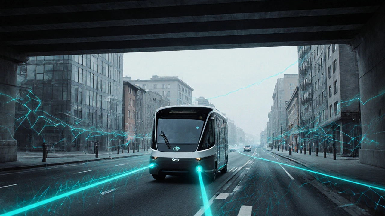
Autonomous shuttles using SmartNav ran with 99.4% operational availability-compared to just 82.1% with standard GPS. For a city trying to deploy driverless transit, that’s the difference between a reliable service and a safety risk.
Dr. Mohamadi, lead researcher at NTNU, put it bluntly: “For autonomous vehicles, this makes the difference between confident, safe behavior and hesitant, unreliable driving.”
The downside? SmartNav needs a lot. It requires multiple sensors, high-quality maps, and complex integration. It’s not something you can drop into a smartphone. It’s built for vehicles, not phones. And it takes over 500 engineering hours to deploy.
Focal Point’s S-GNSS Auto: The Commercial Winner
While academics chase perfection, companies chase practicality. Focal Point Positioning’s S-GNSS Auto is the most widely adopted solution in automotive testing right now.
It’s a firmware upgrade for STMicroelectronics’ Teseo GNSS chips-already used in millions of cars. No new hardware. No sensor fusion. Just smarter signal processing.
Tests in Shinjuku, Frankfurt, and Germany’s Black Forest showed a 3x improvement in position accuracy and 4x improvement in measurement quality. That’s enough to keep a car in its lane, even under overpasses and through tunnel entrances.
It’s also the easiest to deploy. Automakers can update their systems with a single software patch. No need to redesign sensors or rebuild maps. That’s why it’s in 78% of Level 4 autonomous vehicle prototypes in 2025, according to SAE International.
But it’s not magic. It still needs at least 4-5 satellites in view. If the canyon is too deep, even S-GNSS Auto can’t work. And users report inconsistent performance during heavy rain or snow-when atmospheric interference adds another layer of noise.
Still, with a 4.3/5 rating from 37 enterprise users on G2 and seamless integration with Qualcomm’s Snapdragon Ride platforms, it’s the go-to choice for automakers right now.
Which Solution Fits Your Needs?
There’s no single answer. Each solution solves different parts of the problem.
- For smartphone apps or low-cost devices: The HK model is your best bet. It’s free, works with existing chips, and cuts errors in half.
- For autonomous vehicles with budget and sensors: SmartNav delivers unmatched precision-down to 10 centimeters. But only if you can afford the complexity.
- For automakers scaling fast: S-GNSS Auto is the winner. It’s proven, easy to integrate, and already in use by major suppliers.
- For cities with stable, high-res 3D maps: Shadow Matching still holds promise. But it’s not ready for most places yet.
Here’s the real trend: the future isn’t one solution. It’s hybrid systems. NASA’s 2025 paper found 92% of new implementations use at least two methods together. A car might use S-GNSS Auto for baseline positioning, HK model to filter noise, and SmartNav’s carrier phase for lane-level accuracy when signals are strong.
That’s the new standard. No single tool fixes urban canyons. But together, they make it possible.
What’s Next? The Road to 2027 and Beyond
The market for urban canyon GNSS solutions is exploding. It was worth $287 million in 2024. By 2029, it’s projected to hit $1.2 billion.
Why? Because regulations are forcing change. The EU’s General Safety Regulation (GSR2) requires autonomous vehicles to maintain 1.5-meter accuracy in cities by 2026. The U.S. and China are following suit.
Meanwhile, satellite constellations are getting better. Galileo’s full launch in 2025 added 40% more satellites to the sky. More signals mean more chances to find a clear path through the canyon.
By 2027, industry analysts predict sub-50cm urban positioning will become standard. By 2030, McKinsey says every car will have it built-in.
For now, the best approach is to start with what works: upgrade your GNSS software with the HK model, test S-GNSS Auto in your fleet, and keep an eye on SmartNav as it evolves. The canyon isn’t going away. But now, we have the tools to navigate it.
Why does GPS fail in cities with tall buildings?
GPS fails in dense cities because tall buildings block direct signals from satellites, reducing the number of visible satellites to as few as three or four. Signals also bounce off buildings (multipath interference), creating false location readings. The geometry of signals becomes skewed, making it hard to determine direction accurately. These issues combine to cause errors of 10-20 meters, which is dangerous for autonomous vehicles and unreliable for navigation apps.
Can my smartphone get better GPS in the city?
Yes, but only if the manufacturer updates the GNSS firmware. The HK model, developed by NIH, improves accuracy by 22.4 meters in 3D without new hardware. It works by analyzing signal noise patterns and ignoring unreliable signals. Most smartphones today still use outdated algorithms. Look for updates from Apple, Google, or Samsung that mention improved urban positioning or multipath correction.
What’s the most accurate urban GNSS system today?
NTNU’s SmartNav is currently the most accurate, achieving better than 10-centimeter precision 90% of the time in real-world tests in Trondheim. It combines carrier phase measurements, Wi-Fi, mobile networks, and 3D building models. However, it requires complex sensor integration and is not yet available in consumer devices. For now, it’s used in autonomous shuttles and research vehicles.
Are there any commercial products I can buy for better city GPS?
Yes. Focal Point Positioning’s S-GNSS Auto is a firmware upgrade for GNSS chips (like STMicroelectronics’ Teseo) used in many automotive systems. It’s already deployed in prototypes from major automakers and improves position accuracy by 3x. It’s not sold directly to consumers, but if you buy a new car in 2025-2026, it likely has it built-in. For phones, no standalone product exists yet-only software updates from manufacturers.
Will future cars have better GPS than today’s?
Absolutely. By 2027, most autonomous vehicles will use hybrid systems combining multiple technologies: improved GNSS software (like HK), carrier phase tracking (like SmartNav), and sensor fusion. Satellite constellations are expanding, and regulations now require 1.5-meter accuracy in cities. By 2030, sub-50cm urban positioning will be standard in all new vehicles. Your car’s GPS won’t just work better-it’ll be safe enough to drive itself.
9 Responses
Wow, this actually made me feel less frustrated when my Maps sends me down an alley instead of the main road. I thought it was just my phone being dumb.
HK model sounds like the real MVP here. No new hardware, just smarter software? That’s the kind of upgrade I can get behind. 🙌
Wait so if my phone gets a firmware update, it could actually stop sending me to the wrong side of the street? I’ve been blaming my walking for years 😅
Let’s be real - this entire urban navigation paradigm is a neoliberal technocratic fantasy. Shadow Matching? HK Model? These are just Band-Aids on a system designed for Cold War-era satellite surveillance. The real issue is the commodification of spatial data by corporations who profit from your disorientation. We’re not fixing GPS - we’re optimizing alienation. And don’t get me started on how SmartNav’s carrier phase measurements are just a crypto-quantum facade for corporate surveillance capitalism. 🌐👁️
Okay but what if this is all a cover? What if the government’s been using these ‘urban canyon’ problems as an excuse to install micro-drones that track your every move under the guise of ‘navigation correction’? I mean, think about it - why does your phone suddenly know you’re standing still for 47 minutes in front of that bodega? Why does the ‘signal noise’ always spike right after you buy a bag of chips and a soda? They’re not fixing your GPS - they’re mapping your cravings. And the ‘HK model’? That’s just a backdoor to your dopamine patterns. I’ve been using a compass and a paper map since 2019. I don’t trust the sky anymore. 🛰️🫠
You misspelled ‘multipath’ as ‘multipath’ in the third paragraph. Also, ‘GNSS’ is not an acronym that should be followed by a lowercase ‘s’ in ‘S-GNSS Auto’ - it’s a proper noun. And you used ‘it’s’ incorrectly three times. This article reads like a draft from a high school intern.
It is profoundly disheartening to witness the erosion of spatial integrity in our urban environments, reduced to a mere engineering problem solvable by firmware patches and corporate alliances. The very notion that we can ‘fix’ the city’s distortion of truth with algorithms rather than reimagining its architecture is emblematic of our moral decay. We do not need better signals - we need better souls. And yet, here we are, celebrating a 4.7-meter error margin as if it were enlightenment.
SmartNav? In Norway? Of course they got it right - they’ve got 3 million people and 500,000 lakes. Try this tech in Detroit or L.A. where the buildings are falling apart and the streets are named after retired football players. This isn’t innovation - it’s European elitism wrapped in a Wi-Fi blanket. Meanwhile, America’s making S-GNSS Auto work on budget trucks. That’s real progress. Not some fancy Norwegian lab experiment with 500 engineering hours and a $20k price tag.
I’ve lived in Mumbai, Tokyo, and now Chicago, and this article nails something I’ve felt but never articulated: GPS doesn’t fail because of tech - it fails because cities weren’t built for machines. We designed streets for cars, then for phones, now for robots - but never for humans and machines together. The HK model is brilliant because it doesn’t try to rewrite the city. It adapts to the chaos. And hybrid systems? That’s the future. Not one silver bullet, but a symphony of imperfect tools working together - like how we, as people, survive in these concrete jungles. We don’t need perfection. We need resilience. And honestly? That’s the most human part of all this.