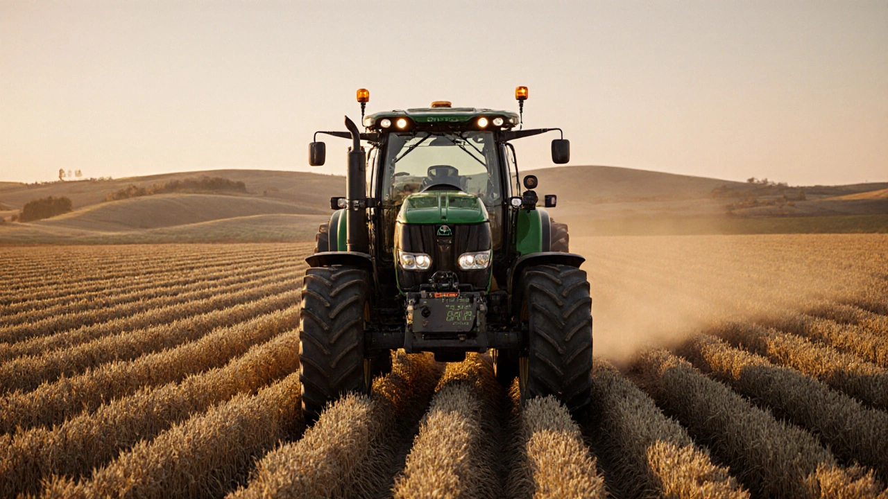
When farmers use RTK farming, a high-precision GPS technique that corrects satellite signals in real time to achieve centimeter-level accuracy. Also known as real-time kinematic positioning, it turns ordinary tractors into self-driving machines that plant seeds in perfect rows, spray fertilizer only where needed, and avoid overlapping fields—saving time, money, and resources. This isn’t science fiction. It’s happening on farms right now, from Iowa to the Australian outback.
RTK farming relies on a network of ground-based reference stations that send correction signals to GPS receivers on farm equipment. These corrections cancel out errors caused by atmospheric interference, satellite drift, and signal bounce—problems that make regular GPS off by several feet. With RTK, a tractor can follow the same path down a field day after day, year after year, within 2 centimeters. That kind of precision means less seed waste, fewer chemical applications, and no double-spraying. It also reduces soil compaction by minimizing unnecessary passes. Farmers using RTK report up to 15% higher yields and 20% lower input costs. And it’s not just for big operations anymore—smaller farms are leasing RTK systems or joining cooperatives to share the cost.
RTK farming connects directly to other technologies shaping modern agriculture. Precision agriculture, the broader practice of using data and technology to manage crops at a hyper-local level depends on RTK as its foundation. Without accurate positioning, variable rate application of water, fertilizer, or pesticides would be guesswork. Agricultural technology, a category that includes drones, soil sensors, and AI-driven analytics feeds data into RTK systems to make real-time decisions. For example, a soil sensor might detect a dry patch, and the RTK-guided tractor automatically adjusts irrigation flow as it passes over it. This synergy turns farming from a seasonal guess into a data-driven science.
What you’ll find in the posts below isn’t a collection of ads or hype—it’s real-world breakdowns of how RTK systems work, what they cost, how they integrate with existing farm gear, and where they’re still falling short. You’ll see how farmers in drought-prone regions use it to stretch every drop of water, how it helps reduce runoff into rivers, and why some early adopters are now training their kids to be both mechanics and data analysts. This isn’t about replacing farmers. It’s about giving them tools to work smarter, not harder—and to do it sustainably.
RTK-guided farming uses satellite corrections to achieve centimeter-level accuracy, reducing input waste by 15-20% and boosting yields by 5-10%. Learn how it works, who benefits, and what it costs.
Learn More