When farmers use GNSS agriculture, a system that uses global navigation satellite signals like GPS, GLONASS, and Galileo to guide equipment and collect field data. Also known as precision farming, it turns traditional guesswork into exact science—letting every seed, drop of water, and pound of fertilizer go exactly where it’s needed. This isn’t science fiction. It’s happening right now on farms from Iowa to Kenya, where tractors drive themselves along GPS lines, sensors track soil moisture in real time, and drones map crop health before a single plant shows signs of stress.
GNSS agriculture relies on a few key technologies working together. Satellite navigation, the backbone of modern field operations, gives sub-inch accuracy when paired with correction signals like RTK. Also known as real-time kinematic positioning, this lets farmers plant rows perfectly straight, avoid overlaps, and reduce fuel use by up to 20%. Then there’s agricultural robotics, autonomous machines that follow GNSS paths to spray, till, or harvest without a human at the wheel. These systems don’t get tired, don’t miss spots, and can work 24 hours a day. And it’s not just about machines. GNSS data feeds into farm management software that shows exactly which parts of a field are underperforming, where nutrients are low, or where pests are spreading. No more spraying the whole field when only 10% needs treatment.
What makes this powerful is how it cuts waste and boosts yields at the same time. A farmer using GNSS can reduce seed usage by 5%, save hundreds of gallons of water per acre, and increase harvests by 10–15%—all without buying new land. It’s also helping small farms compete. You don’t need a billion-dollar operation to benefit. Many GNSS tools now come as affordable add-ons to older tractors, or as smartphone apps that turn any device into a field mapper. And with satellite constellations getting more accurate every year, the tech keeps getting better, cheaper, and easier to use.
Behind the scenes, systems like urban canyon GNSS, a technique developed for city navigation but now adapted for dense crop rows and uneven terrain. Also known as multi-constellation signal fusion, this ensures signals stay strong even under heavy tree cover or near metal barns. The same tech that helps your phone find your way through Manhattan now helps a combine find its way through a cornfield. This isn’t about replacing farmers. It’s about giving them superpowers—better data, less physical strain, and more control over outcomes. Whether you’re running a 10-acre plot or a 10,000-acre operation, GNSS agriculture is no longer optional. It’s the new baseline.
Below, you’ll find real-world examples of how this tech is being used—from automated planters that adjust on the fly to systems that predict crop yields before harvest. These aren’t theory pieces. They’re field-tested solutions from farmers and engineers who’ve seen the results firsthand.
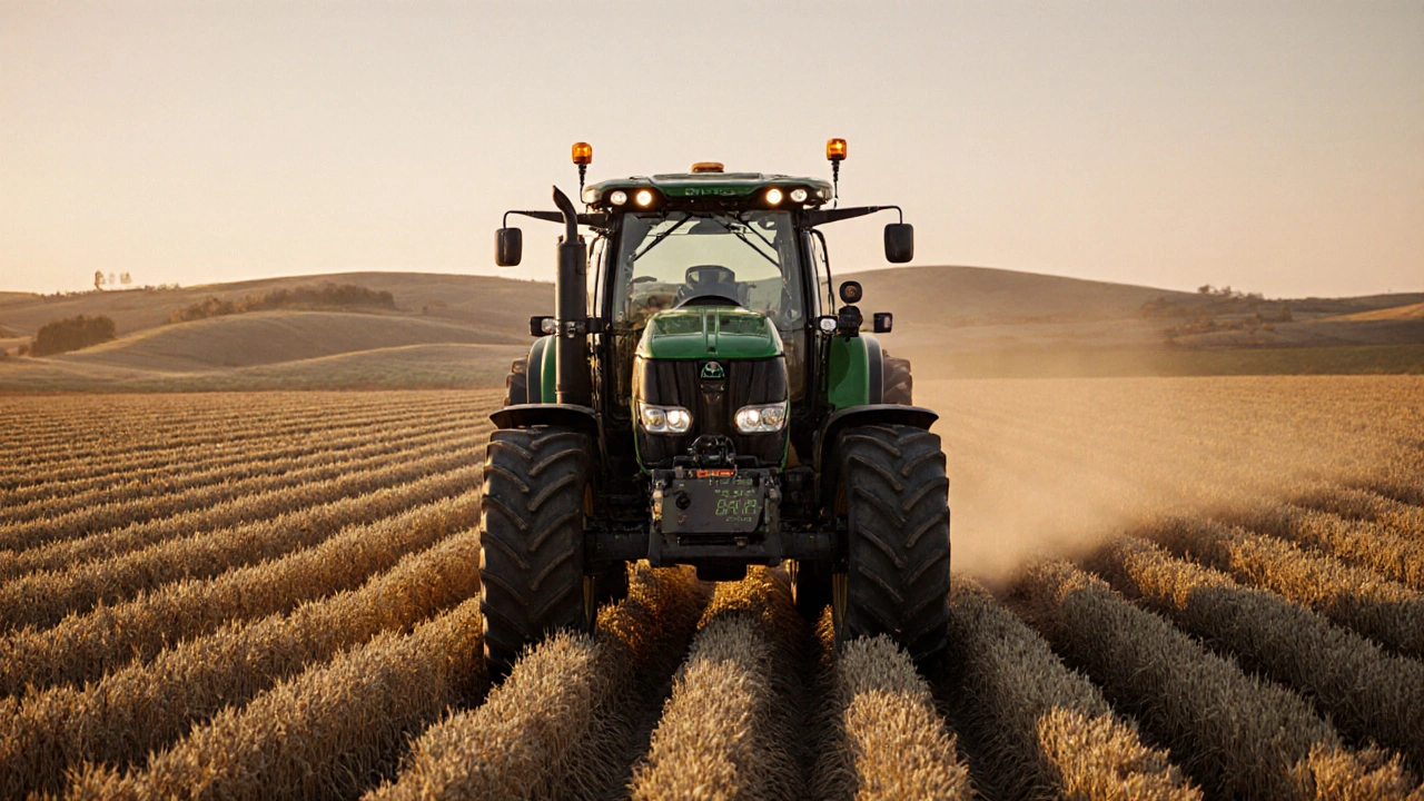
RTK-guided farming uses satellite corrections to achieve centimeter-level accuracy, reducing input waste by 15-20% and boosting yields by 5-10%. Learn how it works, who benefits, and what it costs.
Learn More