

Imagine trying to stitch together a quilt where every patch was cut by a different person using slightly different rulers. The edges won't match. The pattern will look distorted. Now scale that problem up to global climate monitoring. We have dozens of satellites orbiting Earth, each carrying instruments designed to measure temperature, humidity, and radiation. But if those instruments aren't perfectly aligned with one another, the data they produce is useless for detecting long-term climate trends. This is why cross-calibration between space missions is not just a technical detail-it is the backbone of reliable environmental science.
Without rigorous cross-calibration, differences between sensors from different agencies or eras create "noise" that can mask real climate signals. A bias of just 0.5 Kelvin in brightness temperature might seem small, but over decades, it can look like a warming trend when there isn't one, or hide a cooling trend when there is. To solve this, the scientific community relies on systematic frameworks that tie measurements from various platforms to common reference standards. Two major pillars support this effort: the Global Space-based Inter-Calibration System (GSICS) and NASA’s Climate Absolute Radiance and Refractivity Observatory (CLARREO) concept.
The Operational Backbone: GSICS
GSICS doesn't just compare numbers; it manages the entire lifecycle of calibration quality. Its objectives include monitoring instrument performance, performing operational inter-calibration, tying measurements to absolute references, and recalibrating historical records. Think of GSICS as the quality control manager for the world's weather satellites. Agencies like NOAA, EUMETSAT, JMA, and CMA contribute to this system, which produces quarterly bulletins detailing calibration corrections and performance reports.
Why is this necessary? Modern numerical weather prediction models and climate reanalyses require radiances with biases below a few tenths of a kelvin. If you switch from one satellite series to another without correcting for sensor drift or manufacturing differences, your climate dataset breaks. GSICS ensures continuity. For example, when transitioning from NOAA-14 to NOAA-15, analysts use GSICS-derived adjustments to smooth out discontinuities, allowing researchers to detect genuine climate change signals rather than instrumental artifacts.
The Gold Standard: CLARREO and SI Traceability
While GSICS handles the operational coordination, NASA’s CLARREO mission concept aims to provide SI-traceable benchmark spectral radiance observations, acting as an on-orbit absolute standard often described as 'NIST in orbit.' Unlike conventional sensors that rely on relative comparisons, CLARREO provides high-accuracy full spectra covering more than 95% of Earth's radiative energy in both reflected solar and emitted infrared bands.
The goal here is precision at a level previously unattainable. Simulation studies show that using CLARREO as a reference can reduce inter-calibration uncertainties to below 0.1 K (3-sigma) within just one month of observations. This level of accuracy is critical for distinguishing anthropogenic climate signals from natural variability over 20-30-year periods. By serving as an anchor point, CLARREO allows approximately 30-40 instruments in LEO and GEO orbits-including JPSS sensors like VIIRS, CrIS, and CERES-to be calibrated against a single, highly stable truth.
A key component of this strategy is the CLARREO Pathfinder (CPF) mission, which flew on the International Space Station. CPF demonstrated inter-calibration techniques with CERES and VIIRS, proving that SI-traceable measurements could effectively adjust and validate existing instrument calibrations. This paves the way for future missions to bridge gaps in observing systems and improve the reliability of long-range climate projections.
How Cross-Calibration Works: Methods and Techniques
Cross-calibration isn't magic; it's a combination of orbital mechanics, radiometry, and statistics. Several complementary methodologies are used depending on the satellite configuration and instrument type.
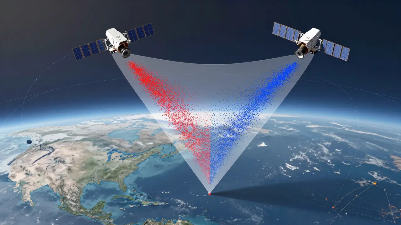
- Simultaneous Nadir Overpass (SNO): This is the most common technique for polar-orbiting satellites. When two satellites pass over the same region nearly simultaneously-defined as being less than 20 km apart with a time difference of under 30 seconds-their nadir pixels are compared. Analysts extract subset data and compute radiance and brightness temperature biases. Any discrepancy is attributed to calibration errors in the target sensor, which are then corrected.
- In-Orbit Reference Sensors: High-accuracy research instruments like NASA’s AIRS, MODIS, and EUMETSAT’s IASI serve as reference standards. Operational sensors are calibrated against these trusted benchmarks at orbit crossing points. However, this method carries risk: if the reference sensor drifts, those errors propagate to all dependent instruments.
- Earth-Based and Extra-Terrestrial Targets: Stable desert sites, long-term ground stations, and celestial bodies like the Sun, Moon, and stars provide constant reference points. Lunar calibration, for instance, helps monitor long-term stability because the Moon’s reflectance properties are well-understood and invariant.
The University of Wisconsin-Madison’s Space Science and Engineering Center (SSEC) has developed detailed workflows for SNO analysis, using orbital perturbation models (SGP4) to predict crossings and perform pixel-by-pixel matching. These processes require specialized skills in radiative transfer and statistical analysis, highlighting the complexity behind seemingly simple data corrections.
Comparing Calibration Approaches
| Method | Reference Type | Achievable Uncertainty | Primary Use Case |
|---|---|---|---|
| SNO Inter-calibration | Operational Satellite Pairs | Few tenths of a Kelvin | Polar-orbiting sensor continuity |
| GSICS Framework | Multiple References (AIRS, MODIS, etc.) | Climate-relevant thresholds | Global operational constellation management |
| CLARREO Benchmark | SI-Traceable On-Orbit Standard | <0.1 K (3-sigma) | High-precision climate trend detection |
| Lunar/Desert Targets | Natural/Celestial Bodies | Variable (depends on site stability) | Long-term drift monitoring |
Each approach has trade-offs. SNO is operationally efficient for frequent crossings but struggles with GEO-LEO mismatches. GSICS offers broad coverage but depends on the stability of its reference instruments. CLARREO provides superior accuracy but is limited by mission lifetime and funding cycles. The future lies in integrating these methods, using CLARREO-like benchmarks to anchor the GSICS network, thereby reducing systemic biases across the entire fleet.

Why Data Consistency Matters for Climate Science
The stakes are high. Without rigorous inter-calibration, composite time series become unsuitable for detecting small decadal climate signals. Goldberg et al. (2011) noted that uncorrected inter-sensor biases could masquerade as climate trends, leading to flawed policy decisions. Conversely, accurate cross-calibration enables robust retrieval of atmospheric temperature and water vapor profiles, even under extreme scenarios like a 100-year CO₂ doubling experiment.
This consistency supports not only climate research but also operational weather forecasting. Numerical weather prediction models ingest satellite radiances directly. If those radiances contain biases, forecast accuracy suffers. GSICS-derived corrections are now embedded in data assimilation pipelines at centers like NOAA’s National Centers for Environmental Prediction, demonstrating institutional confidence in these practices.
Furthermore, as satellite constellations grow-especially with virtual constellations for aerosols and trace gases-the need for standardized calibration strategies intensifies. CEOS AC-VC presentations from 2023 highlight efforts to extend GSICS concepts beyond traditional imagers, ensuring that new thematic observing systems maintain data integrity from day one.
Challenges and Future Directions
Despite progress, challenges remain. Reference sensor drift is a persistent risk. If AIRS or MODIS experiences uncharacterized spectral changes, the entire calibration chain is compromised. This motivates the push for absolute benchmarks like CLARREO, which are tied to National Institute of Standards and Technology (NIST) standards, minimizing dependency on other satellites.
Another challenge is the learning curve. Analysts must master complex workflows involving orbital predictions, radiative transfer modeling, and statistical bias computation. Training takes months, and expertise is concentrated in specialized institutions. Expanding capacity requires better documentation and shared tools, such as open-source SNO prediction algorithms.
Looking ahead, the integration of CLARREO Pathfinder results into operational workflows marks a significant step. As GSICS expands its portfolio to include GEO imagers and archived data recalibration, the framework becomes more resilient. The ultimate goal is a seamless global observing system where any scientist, anywhere, can trust that satellite data from 2026 is directly comparable to data from 2005.
What is cross-calibration between space missions?
Cross-calibration is the process of relating measurements from one satellite instrument to a better-characterized reference instrument to ensure data consistency across different platforms, agencies, and time periods. It reduces biases so that combined datasets accurately reflect real-world conditions.
Why is GSICS important for weather forecasting?
GSICS ensures that operational satellite instruments provide consistent, accurate data required for numerical weather prediction models. By monitoring performance and applying calibration corrections, GSICS prevents discontinuities when switching between satellite generations, maintaining forecast reliability.
How does CLARREO improve climate data accuracy?
CLARREO provides SI-traceable, high-accuracy spectral radiance observations that serve as an absolute on-orbit standard. This allows other sensors to be calibrated with uncertainties below 0.1 K, enabling precise detection of long-term climate trends that would otherwise be obscured by instrumental noise.
What is Simultaneous Nadir Overpass (SNO)?
SNO is a technique where two satellites pass over the same location nearly simultaneously. Their measurements are compared pixel-by-pixel to identify and correct calibration biases between the sensors, ensuring consistency across the satellite fleet.
Who uses cross-calibrated satellite data?
Institutional users such as national weather services, climate research centers, and satellite agencies use cross-calibrated data for weather forecasting, climate monitoring, and environmental applications. Accurate data supports sectors like agriculture, energy, and transportation that depend on reliable weather and climate information.